One river and two falls
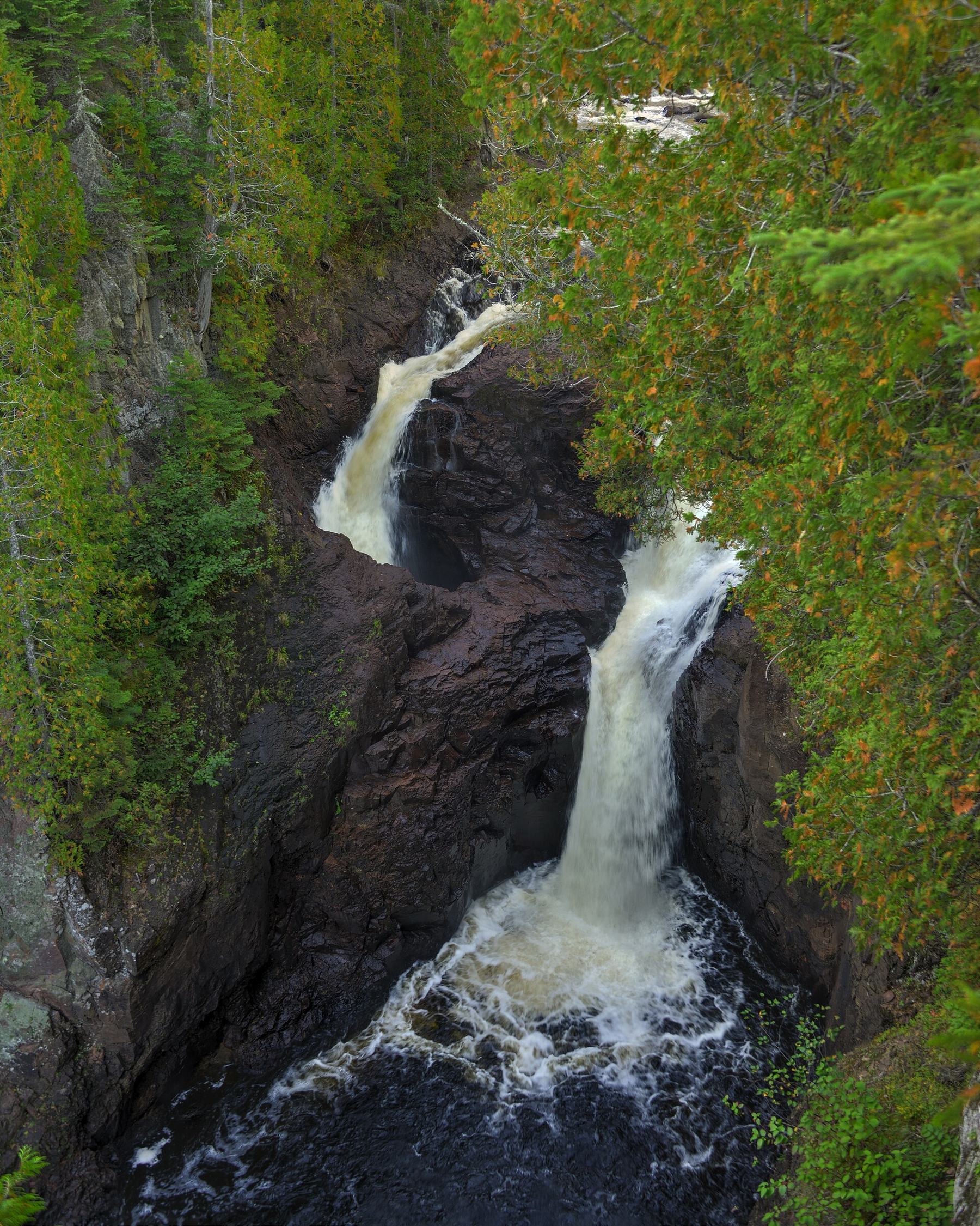
In Judge C. R. Magney State Park on Lake Superior's North Shore, the Brule River divides around an outcrop of volcanic rock. Its eastern branch drops conventionally into an open pool. The western branch plunges into a deep rock pothole called Devil's Kettle. From the overlook, its continuation is hidden. The contrast between adjacent branches sustained the question of where that water disappeared.
Visitors described throwing sticks and other floating objects into the kettle without seeing them emerge downstream. A separate underground route directly to the lake became a popular suggestion. Failure to recover an object did not demonstrate missing water, however: material could remain trapped, disintegrate or pass unnoticed. An experiment measuring the flow itself was needed.
The hydrologist's question
Jeff Green of the Minnesota Department of Natural Resources thought the western branch returned to the river below the falls. He asked the agency's water monitoring unit to compare total discharge above and below the puzzling section. This approach did not require seeing an internal cavity or knowing the exit beforehand. If a substantial fraction of the river followed a separate route, the downstream measurement should reveal the corresponding loss.
In late autumn 2016 Heather Emerson and Jon Libbey measured 123 cubic feet per second above the falls and 121 several hundred feet below them. Green explained that the difference lay within equipment tolerances. Those numbers must be read with their uncertainty rather than turning the small difference into evidence for a tiny secret outlet. Within the measurement's resolution, the river retained its flow.
Why a tunnel to the lake is unnecessary
A DNR account published in 2017 interpreted the result as water rejoining the channel. Regional geology also failed to support the popular image of a long open tunnel. Hard volcanic rocks differ from soluble limestone, where extensive karst conduits commonly develop. The visible hole by itself did not establish such a route.
Green's colleague Calvin Alexander explained the apparent disappearance of objects through strong recirculating currents in the plunge pool. These can retain and break up material while water continues through the system. DNR also described a proposed fluorescent dye experiment for autumn 2017. The source's tense matters: that was a planned additional investigation, not a reported completed tracing result. The decisive flow measurements had already been made in 2016.
Comparing observation with inference
A water balance offers a more direct answer here than repeatedly throwing objects into the hole. It strongly contradicts a large continuing loss from the measured river section, but does not map every stream of water inside the rock. The explanation is natural and testable: water returns downstream even when spectators cannot distinguish the exit. Preserving that limitation makes the account more accurate than either a bottomless abyss story or a claim that the entire underground geometry has been mapped.