The cloud arrives around dawn
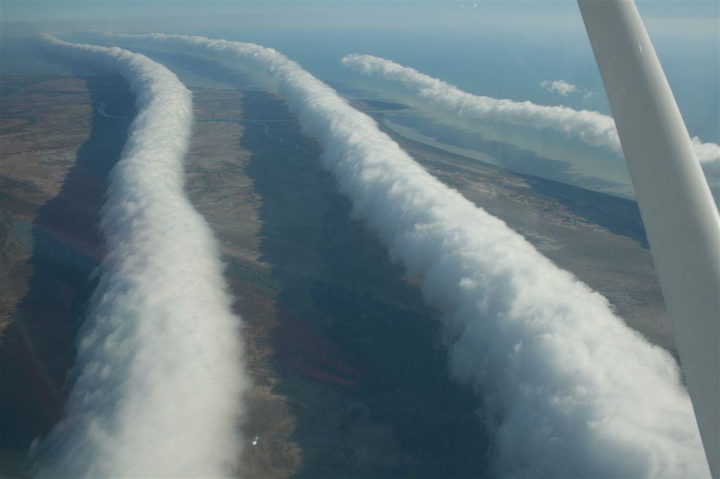
Residents of Burketown near the southern Gulf of Carpentaria know mornings when a long, smooth cloud roll appears on the horizon. Further rolls sometimes follow, marking the sky with parallel bands. The phenomenon is called the Morning Glory. It is particularly associated with the local spring, although an impressive photograph does not imply a daily appearance. Visible cloud requires a suitable combination of air motion, atmospheric stability and humidity.
Glider pilots travel to this remote region for the lift ahead of the roll. From the cockpit, the cloud can resemble a wall even as the disturbance travels across the landscape. A pilot attempts to remain within rising air on the front side of the wave. Air movement changes behind the crest, making the encounter an experience of atmospheric dynamics as well as unusual scenery.
Balloons and an instrumented aircraft
Researcher Roger Smith describes field campaigns comparing surface weather with measurements over the gulf. His account illustrates the 1982 expedition using radiosonde launches at Burketown, tracked balloons for wind measurements and sensors carried by a light aircraft. These observations supplied vertical profiles of temperature, humidity and air motion. Such structure distinguishes a travelling wave from an ordinary cloud band drifting with the wind.
Times when cloud disappears also matter. A wave can continue through air too dry for condensation, leaving pressure and wind changes without a visible roll. The region offers a natural experiment in which cloud only partly reveals the underlying disturbance. Photography is valuable, but cannot replace observations at the surface and at different heights. Different instruments answer different questions about the same process.
Where the sea breezes meet
Australia's Bureau of Meteorology relates characteristic northeasterly Morning Glories to sea breezes on opposite sides of Cape York Peninsula. Daytime heating draws air inland from the Coral Sea and the gulf. Their interaction, followed by evening cooling over land, can initiate a disturbance. Over the gulf, a stable layer with a temperature inversion provides conditions in which waves can travel considerable distances.
Air rises on the leading side, cools and forms cloud as water vapor condenses. Behind it, descending air warms and droplets evaporate. This continuing creation and removal makes the cloud appear to roll. The same droplets need not travel along the entire route. The formation's remarkable length reflects an extensive region with suitable conditions, rather than a single solid object crossing the sky.
Comparing different cloud rolls
Not every Morning Glory approaches from the same direction. Field research describes southerly examples associated with fronts crossing Australia, with less completely resolved formation details. The broad interpretation as wave motion in a stable atmospheric structure is supported by measurements, but cannot provide a timetable for every morning. Unlike an isolated historical anomaly, this is a recurring phenomenon with variable conditions. The map point marks the regular observing region around Burketown rather than the birthplace of every cloud, and no single discovery year is assigned to the continuing process.